
Featured Purchase Your Heritage Pass
A coastal walk with fantastic views and a hidden guardhouse
Set off from the Driftwood Café, head inland away from the beach. As you start your walk up the hill, you pass by Archirondel Cottage on your right. This was built around 1820 by Edward Noel but the cottage was bought by the British government in 1847 as part of a project to construct a harbour of refuge in the bay of St Catherine for the Royal Navy. The cottage was given back to the Island in 1878 and remained in public ownership for over 130 years. During the Occupation, the Germans built a series of defensive structures known as ‘Resistance Nest Archirondel’ in the gardens and land adjacent to the cottage.
At the top of the hill, turn right and pause by St Agatha, an early 19th century house that still retains many historic features. The name is associated with the 14th century chapel dedicated to St Agatha that was demolished in 1852 as part of the harbour building project.
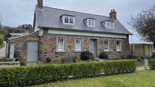
Archirondel Cottage
The Millennium Cross records the existence of another medieval chapel that was lost to the harbour project, La Chapelle de St Catherine. After the Reformation, the two chapels fell into disrepair and were demolished in the mid-19th century during the building of the breakwater.
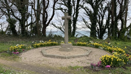
The Millennium Cross
After a short distance there is a gap in the granite wall on your left which leads to a Napoleonic guardhouse. You can take a closer look or continue along the road from where it is also visible. The guardhouse was built around 1810 and was part of a chain of defensive structures built in coastal positions. They were used by the local militia to maintain a guard and keep watch on coastal waters, particularly near to potential landing places. It comprises a brick vaulted magazine room for storing gunpowder and a smaller guardroom.
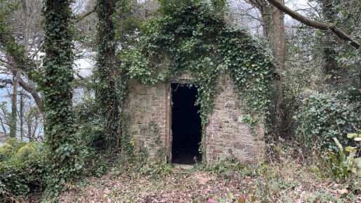
Napoleonic guardhouse
Note the unusual stone at the fork of the two roads. It has the house name L’Oasis and two dates – 1891 AD and also 6854 AM which stands for Anno Mundi and is a calendar based on biblical accounts of the creation of the world. On the right you will pass a house called La Vieille Chapelle that is thought to be the site of the priest’s house associated with La Chapelle de St Catherine.
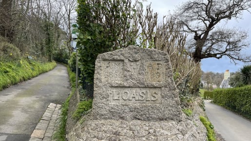
L’Oasis stone
Embedded in the wall on the left hand side you will see a drinking fountain for local farm workers. This example has a stone bowl backed with a Late Victorian glazed tile.
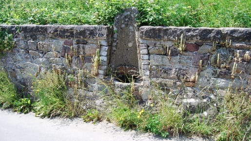
Drinking fountain
Mill Farm is an historic mill house and watermill known as Le Moulin de la Perelle. It probably dates from the medieval period and is an important part of the Island’s industrial past. In 1848 the mill was sold to the Crown which was acquiring all the coastal land between Gorey and Flicquet in advance of the building of St Catherine’s Breakwater.
Take the turning on the right and walk down the hill past Rock Cottage, again taking great care of any oncoming traffic. At the bottom of this hill, carefully cross the main road and join the coastal footpath at Belval Cove.
Turn right and head back along the path towards Archirondel
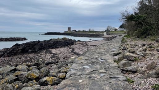
Coastal pathway
As you approach the bay where the lifeboat is stationed, the footpath runs below a small but significant building called L’Hopital. This 19th century cottage was converted for use as a hospital around 1850 to treat workers injured while building St Catherine’s Breakwater and to serve as a clinic for the children of the workforce.
The granite tower that dominates the bay, known as White Tower, forms part of the chain of towers built to defend the Island against French invasion during the Napoleonic Wars. At the top of the slipway by the Lifeboat Station is the head of a stone cross dating from the 15th century.
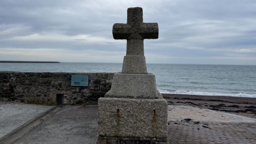
Stone cross
You will pass the site of Le Huquet’s shipbuilding yard where a number of ships were built during the 19th century when Jersey had a booming shipbuilding industry. The largest vessel built here was a 182 tonne brigantine called ‘Britain’s Pride’.
At the end of the path, as you approach Archirondel, you will see a yellow ‘Power Cable’ sign marking one of the undersea cables which supplies up to 95% of Jersey’s electricity requirements from low-carbon hydro and nuclear sources in France. At the edge of the slipway is a German fortification overlooking the bay towards St Catherine, part of Hitler’s Atlantic Wall. Resistance Nest Archirondel housed machine guns, a tank gun, flame throwers and a searchlight.
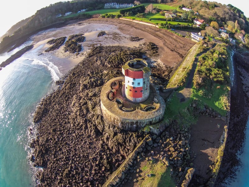
This is one of 23 Conway towers built between 1778 and 1801 in coastal locations where there was a risk of enemy landing. By the side of the Tower lies the unfinished Archirondel breakwater. The Royal Navy had begun a programme of strengthening the Channel Islands against French attack after the defeat of Napoleon in 1815, with an anchorage in St Catherine’s as part of their plans. The breakwater you see now is all that remains of the abandoned southern arm of the harbour. The northern breakwater was completed in the early 1850s although the naval project was abandoned soon after and ownership transferred to the Island authorities in 1878.
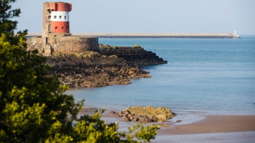
Archirondel Tower
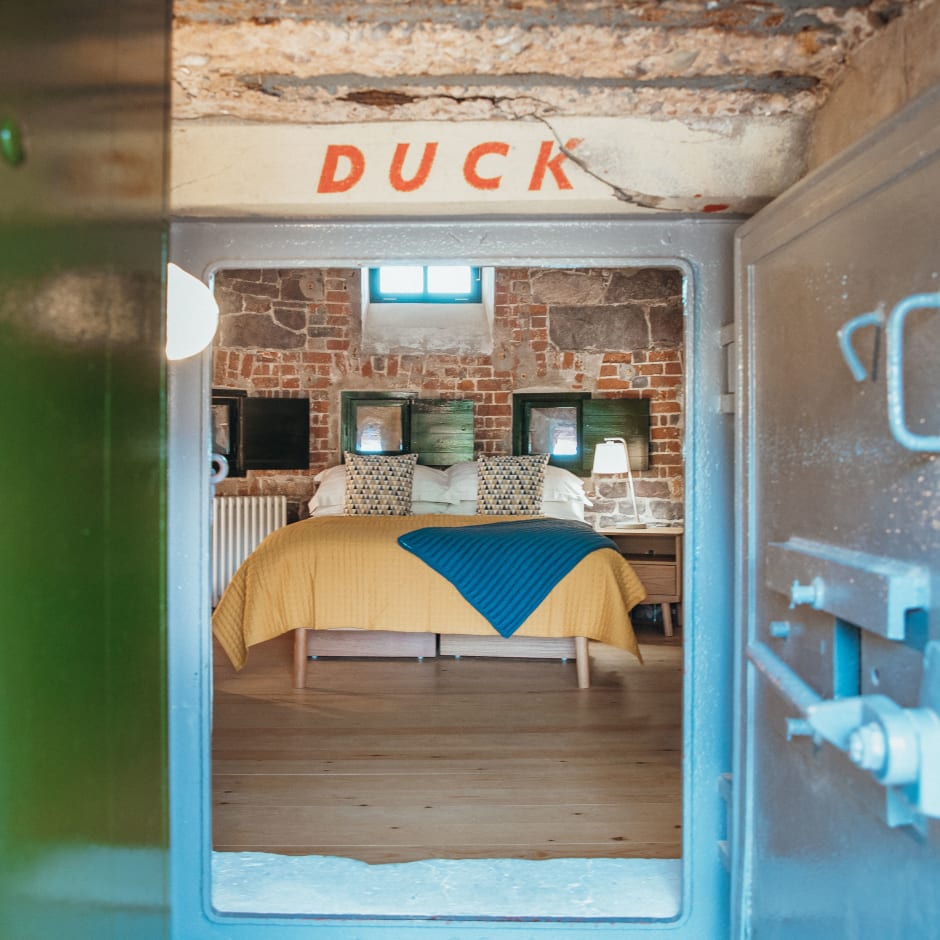
Overlooking this tranquil bay is a unique historic Tower that has been converted into self-catering accommodation. It’s great for an Island adventure!
Walk
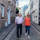
A stroll around the picturesque St Aubin’s Village with its fascinating history of cod fishing, privateers and railways.

What's On
The free Visitor Centre will help you to understand and explore Jersey.
Places to Visit
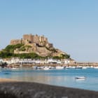
A medieval castle with links to the English Crown and amazing views across to France.

Places to Visit
A free-to-access dolmen built around 6,000 years ago to align with the rising sun on the spring and autumn equinox.