
Featured Purchase Your Heritage Pass

A walk along quiet roads and footpaths
Start this walk opposite the small pink cottage called West View that stands on the main road opposite the top of the slipway at La Pulente.
This cottage dates from the 1850s and probably housed workers for the nearby quarry on La Pulente Hill. By the 1901 census, the occupants of West View were listed as ‘seaweed gatherers’, at a time when the collection of vraic (seaweed) was a profitable business. One unusual feature of this cottage is that the main entrance is at the rear.
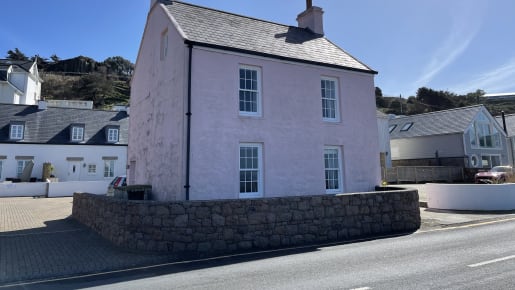
West View Cottage
A little further along, there is a large granite abreuvoir on the edge of the road, dating from 1871. Abreuvoirs were drinking places for cattle and horses, a reminder of a time when animals played an essential role in transport and working life. There is a very similar abreuvoir located at the top of the hill.
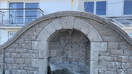
Abreuvoir
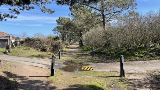
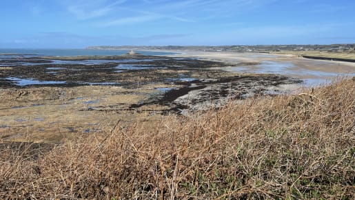
From here, you have a good view of the seawall that protects St Ouen’s Bay. This dates back to the early 19 th century and was built to prevent the loss of farmland to the sea. The slipways were not constructed until the threat of French invasion had passed, for fear they might provide ideal landing points for troops. Most slipways date from the mid-19 th century and were built to allow access to the shore to gather vraic or to launch a small boat. The cobbles, or setts, were traditionally laid at a raked angle to provide a firmer footing and to prevent cartwheels and horses hooves
from slipping.
Many slipways were blocked off or dissected by anti-tank walls constructed by the German occupying forces in the 1940s. After the war, the slipways were re-opened.
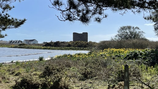
On the corner, you will find Resistance Nest Oeillère, part of an integrated network of German fortifications constructed in Jersey during the Second World War that formed part of Hitler’s Atlantic Wall. The gun turret was removed in the last year of the war and relocated – probably to La Rocque – when an Allied invasion from the east was expected.
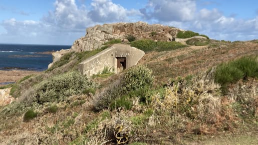
Resistance Nest Oeillère
Follow the footpath round to the small bay of Petit Port, taking care on the uneven steps along the top of the slipway. If the tide is low, you may be able to spot the tracks carved out of the rock that allowed Islanders with carts to harvest vraic from this rocky bay. Today, these tracks are used by local low water fishermen for easier access to the intertidal zone. From here, there are extensive views across the bay towards the lighthouse at La Corbière that was built in 1874 to warn ships of the treacherous rocks at this south-westerly tip of the Island. It was the first lighthouse in the British Isles to be constructed of concrete.
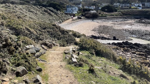
Pathway to Petit Port
Before you reach the small granite pumping station, there is a footpath signposted up a steep flight of steps that will take you up the hillside to join the Railway Walk. This popular walking and cycle route follows the path of the Jersey Western Railway Line that used to run from St Aubin to La Corbière.
Railway Walk
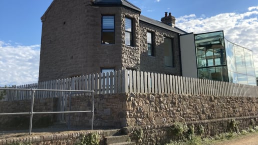
Here you can see the old Station House (now converted into a private property with modern glass extension). The station opened in 1899 when the railway line was extended from La Moye to carry Victorian daytrippers all the way to La Corbière with its stunning views and tearooms. It incorporated the station master’s house, booking office and waiting rooms.
Station House
Opposite the Station House, lies a very large ancient stone known as La Table des Marthes. According to local folklore, the stone was a site for the signing of legal contracts. The original form of this Neolithic monument is unknown and its surroundings were considerably altered when the railway was constructed, but it is an impressive sight nonetheless.

La Table des Marthes
After a short distance, note the tall granite structure to your right across an open field on the far side of the main road. This is the stone crushing house for the quarry that operated here during the 19 th century. The quarry at La Moye, known as La Rosiére, supplied high-class pink granite for building and decoration within the Island and for export, including stone for the construction of the Victoria Embankment in London.
Stone crushing house
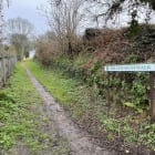
As you approach the bottom of the hill, you will see a footpath signposted on the right hand side of the road.
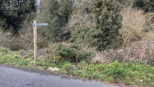
Footpath signpost
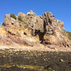
At the summit, you will find La Sergenté, an early Neolithic passage grave dating from around 4500BC that was discovered and excavated in 1923. It is the earliest type of passage grave known and provides an important link to identical sites in Brittany and Normandy. No bones were found during excavations but they are unlikely to have survived in the type of soil on this headland. Most of the stone used is granite from Mont Fiquet, 2km to the east.

La Sergenté
This headland is known as L’Oeillère and is an important prehistoric landscape where Neolithic pottery and stones have been found. L’Oeillère means ‘a peep hole’ and the name suggests that there was once a look-out tower here or perhaps a rock with a hole in it.
L’Oeillère
Walk
A lovely walk along leafy lanes and little-known footpaths, exploring deep into the Trinity countryside.

What's On
The free Visitor Centre will help you to understand and explore Jersey.
History
At La Cotte de St Brelade (La Cotte) in Jersey, appearances are deceptive but there is more to it than meets the eye.